SeeTrack
Our internationally proven, multi-domain, command and control system
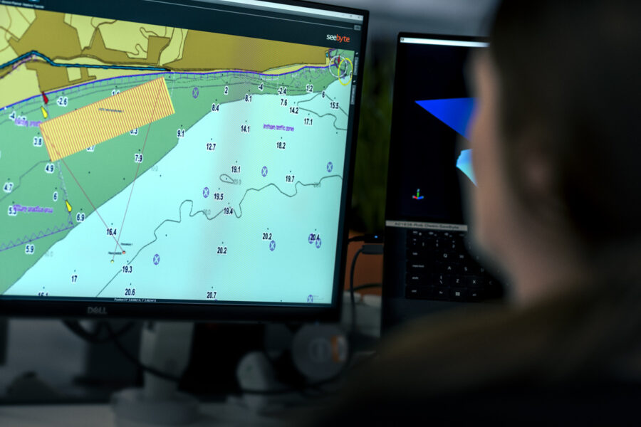
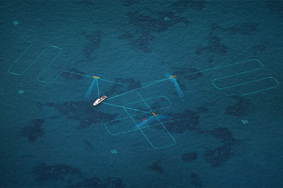
SeeTrack provides mission planning, monitoring, and data analysis for single or multi-vehicle operations. As a vendor-neutral solution, SeeTrack has been integrated with numerous world leading robotic and autonomous systems. SeeTrack ensures users learns a single way of working, using a common user interface, and suite of tools to operate multiple assets.
Interoperability
SeeTrack enables navies to effectively collaborate across nations. Through a single integrated system navies can manage assets across the entire fleet. In water trials involving multiple navies provide invaluable user feedback to develop and refine this capability.
View Case Study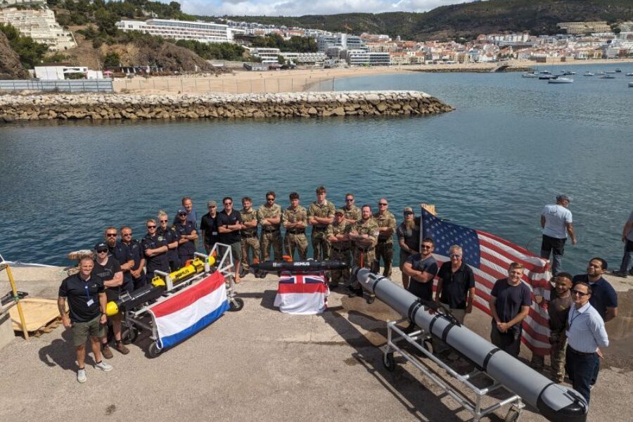
Interchangeability
SeeTrack can enable vehicles and payloads to be upgraded or replaced without impact to user workflow or retraining. Urgent operational requirements can be added quickly to address emergent threats, commanders intent, or conduct a unique mission set.
Data Analysis
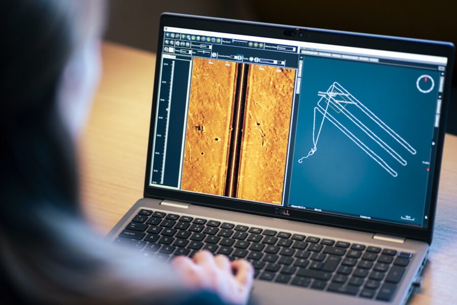
SeeTrack is designed to handle large volumes of high-resolution data from multiple sensors. Mission review capabilities include target picking using the waterfall sonar review, sensor mosaic tools, and custom report generation.
Vehicle Agnostic
SeeTrack can effectively manage a diverse fleet of assets through a single, integrated user interface, while retaining each assets unique capabilities. Our commercially controlled open architecture means new sensors, sonars, or platforms can be integrated at any stage.
Related products
-
Neptune
-
Neptune is an intelligent autonomy system that enables mission level and collaborative autonomy for complex, multi-vehicle operations.
-
ATR System
-
Our ATR System provides a comprehensive suite of tools for operator-assisted ATR and can be tuned for a variety of target types and environments.
-
Training & Support
-
We offer comprehensive on-site theoretical and practical training in all our products. We also offer remote and on-site support for users.
Supported Platforms
Artemis
(Blueprint Subsea)
Bluefin Robotics
(GDMS)
Iver 2/Iver 3
L3 Harris)
REMUS (HII)
Supported Side Scan Sonar
EdgeTech
Klein
(MIND-Technology)
Kraken MINSAS
and KATFISH
Marine Sonic
Technology
Sonardyne Solstice
Supported Forward Look Sonar
Teledyne BlueView
SeeTrack FAQ's
Recommended System Requirements
- Operating System: Windows 11
- Intel i7 processor (generation 10)
- Solid State Drive (SSD)
- 1 TB free disk drive space
- 32 GB RAM
- Graphics card: Nvidia GPU 8GB RAM
- Internet connection recommended, but not essential
- Windows installed using English language and US/UK locale
- Web browser with HTML and PDF viewing capability
Generally we provide licenses via an activation file, and in some circumstances we provide USB HASP keys. SeeByte Product licenses are tied to the hardware the software is installed on, and each license has its' own unique ID. Licenses can be either time based or perpetual depending on what has been agreed.
We offer a support service, please contact support@seebyte.com and provide as much detail as you can such as software versions, steps to reproduce the issue and any screenshots you are able to provide.
SeeTrack Mission Planner is designed to generate single vehicle plans in the native mission format. Neptune utilises our onboard autonomy, allowing multi-vehicle collaborative missions.
SeeTrack comes with offline low resolution satellite imagery. If the computer has an internet connection, higher resolution imagery will render from NASA Worldwind. Users have the option to copy cached mapped data from online systems if the operational system is not allowed online. SeeTrack also supports nautical charts (ENCs) and georeferenced imagery (geotiffs).
SeeTrack allows users to analyse Sidescan Sonar, Forward Looks Sonar (FLS) and video and multibeam (MBE) data from various vendors, as well as vehicle position and altitude.
We have integrated with multiple assets including HII REMUS, Atlas Elektronic SeaCat, Artemis PRO handheld Sonar, VideoRay Defender, OceanServer IVER and Teledyne Marine Gavia. If you'd like to know if we can, or currently support, a particular asset please contact sales@seebyte.com.